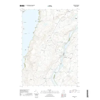
2019 Map of Putnam
USGS Topo · Published 2019About this map
Lake George and Lake Champlain dominate this landscape, separated by the steep, wooded heights of Adirondack Park. The terrain is defined by dramatic elevation changes, rising from the waters of The Narrows to summits like Spruce Mtn and Hogback Mtn. Smaller settlements and landings are scattered throughout this corridor, including Hague, Dresden, and Putnam, which are connected by winding routes such as Military Rd and Dresden Hill Rd. Local history is preserved in sites like the Putnam Cem and Gillette Cem, while the rugged geography is marked by numerous islands and points, such as Racket Island and Burnt Point. The map illustrates a region where transportation was historically dictated by the narrow valley between the two major lakes, with Putnam Station and Chilson Bend serving as key points along the eastern shore of Lake Champlain.
Find a feature on this map
91 named features on this map. Tap any name to fly to it.
Don’t see what you’re looking for? This feature index may not catch every label — zoom into the map to look around manually.
Map Details
Editions of this 2019 Putnam Map
This is the sole edition of this map. No revisions or reprints were ever made.
Other maps of this area

1893 · Whitehall
USGS Topo · 1:62,500

1894 · Ticonderoga
USGS Topo · 1:62,500

1895 · Whitehall
USGS Topo · 1:62,500

1895 · Paradox Lake
USGS Topo · 1:62,500

1896 · Ticonderoga
USGS Topo · 1:62,500

1897 · Bolton
USGS Topo · 1:62,500

1897 · Paradox Lake
USGS Topo · 1:62,500

1898 · Whitehall
USGS Topo · 1:62,500

1900 · Bolton
USGS Topo · 1:62,500

1902 · Whitehall
USGS Topo · 1:62,500