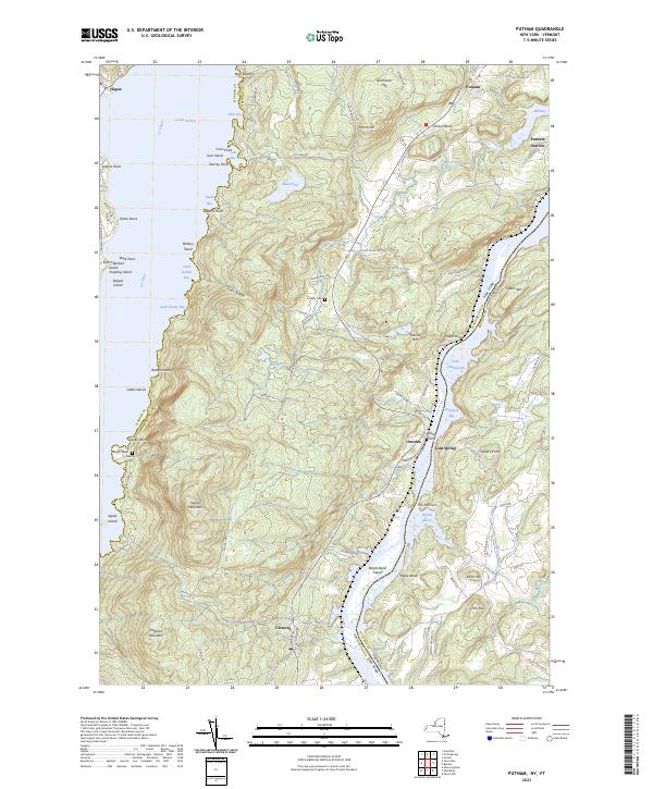
2023 Map of Putnam
USGS Topo · Published 2023About this map
Lake George and Lake Champlain dominate this landscape, with the steep topography of Spruce Mountain and Hogback Mountain defining the narrow corridor between these two iconic water bodies. The settlement of Putnam Station and the hamlet of Putnam serve as historical anchors along the eastern shore of Lake George, while Dresden and Clemons occupy the lower reaches near The Narrows. This area is characterized by its dramatic transition from waterfront to high peaks, much of which is protected within the Adirondack Park.
Find a feature on this map
102 named features on this map. Tap any name to fly to it.
Don’t see what you’re looking for? This feature index may not catch every label — zoom into the map to look around manually.
Map Details
Editions of this 2023 Putnam Map
This is the sole edition of this map. No revisions or reprints were ever made.
Other maps of this area

1893 · Whitehall
USGS Topo · 1:62,500

1894 · Ticonderoga
USGS Topo · 1:62,500

1895 · Whitehall
USGS Topo · 1:62,500

1895 · Paradox Lake
USGS Topo · 1:62,500

1896 · Ticonderoga
USGS Topo · 1:62,500

1897 · Bolton
USGS Topo · 1:62,500

1897 · Paradox Lake
USGS Topo · 1:62,500

1898 · Whitehall
USGS Topo · 1:62,500

1900 · Bolton
USGS Topo · 1:62,500

1902 · Whitehall
USGS Topo · 1:62,500