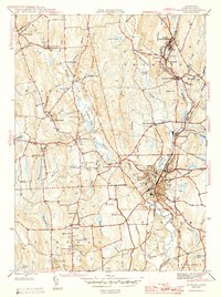
1945 Map of Putnam
USGS Topo · Published 1945About this map
The Quinebaug River and French River converge in this mid-1940s landscape, driving the industrial and social development of northeastern Connecticut. The city of Putnam serves as a central hub, anchored by institutions like Putnam Academy and the Day-Kimball Hospital. The influence of the New York New Haven and Hartford railroad is evident, threading through riverfront mill towns like Mechanicsville and Grosvenordale.
Find a feature on this map
83 named features on this map. Tap any name to fly to it.
Don’t see what you’re looking for? This feature index may not catch every label — zoom into the map to look around manually.
Map Details
Editions of this 1945 Putnam Map
2 editions found
Other maps of this area

1887 · Brookfield
USGS Topo · 1:62,500

1889 · Webster
USGS Topo · 1:62,500

1889 · Putnam
USGS Topo · 1:62,500

1890 · Brookfield
USGS Topo · 1:62,500

1892 · Woodstock
USGS Topo · 1:62,500

1892 · Webster
USGS Topo · 1:62,500

1893 · Putnam
USGS Topo · 1:62,500

1893 · Brookfield
USGS Topo · 1:62,500

1908 · Quinsigamond
USGS Topo · 1:125,000

1908 · Ware
USGS Topo · 1:125,000