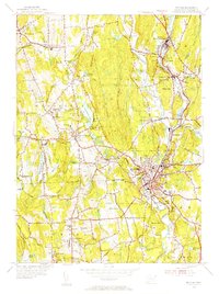
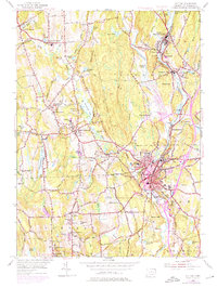
1955 Map of Putnam
USGS Topo · Published 1956About this map
Putnam and its surrounding mill towns are centers of industry and education along the Quinebaug River in the mid-1950s. The landscape is defined by the heavy rail presence of the New York New Haven and Hartford railroad, which links the commercial centers of North Grosvenor Dale and Grosvenor Dale with the regional hub of Putnam. Higher education and specialized institutions are prominent across the quadrangle, including the historic Woodstock Academy, Annhurst College, and the Day Kimball Hospital complex.
Find a feature on this map
65 named features on this map. Tap any name to fly to it.
Don’t see what you’re looking for? This feature index may not catch every label — zoom into the map to look around manually.
Map Details
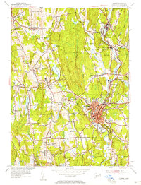
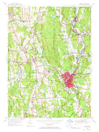
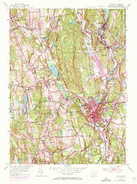
Editions of this 1955 Putnam Map
6 editions found
Historical Maps of Killingly Through Time
77 maps found

1889 Putnam
Windham County, CT

1892 Woodstock
Windham County, CT

1893 Putnam
Windham County, CT

1919 Putnam
Windham County, CT

1921 Woodstock
Windham County, CT

1943 Plainfield
Windham County, CT

1944 Hampton
Windham County, CT

1944 Oneco
Windham County, CT

1945 Eastford
Windham County, CT

1945 East Killingly
Windham County, CT

1945 Putnam
Windham County, CT

1945 Westford
Windham County, CT

1946 Scotland
Windham County, CT

1950 East Killingly
Windham County, CT

1952 Westford
Windham County, CT

1953 Eastford
Windham County, CT

1953 Hampton
Windham County, CT

1953 Oneco
Windham County, CT

1953 Plainfield
Windham County, CT

1953 Scotland
Windham County, CT

1955 East Killingly
Windham County, CT

1955 Putnam
Windham County, CT

1955 Thompson
Windham County, CT

1983 Eastford
Windham County, CT

1983 Plainfield
Windham County, CT

1983 Scotland
Windham County, CT

1983 Westford
Windham County, CT

1984 Hampton
Windham County, CT

2012 Eastford
Windham County, CT

2012 East Killingly
Windham County, CT

2012 Hampton
Windham County, CT

2012 Oneco
Windham County, CT

2012 Plainfield
Windham County, CT

2012 Putnam
Windham County, CT

2012 Scotland
Windham County, CT

2012 Thompson
Windham County, CT

2012 Westford
Windham County, CT

2015 Eastford
Windham County, CT

2015 East Killingly
Windham County, CT

2015 Hampton
Windham County, CT

2015 Oneco
Windham County, CT

2015 Plainfield
Windham County, CT

2015 Putnam
Windham County, CT

2015 Scotland
Windham County, CT

2015 Thompson
Windham County, CT

2015 Westford
Windham County, CT

2018 Eastford
Windham County, CT

2018 East Killingly
Windham County, CT

2018 Hampton
Windham County, CT

2018 Oneco
Windham County, CT

2018 Plainfield
Windham County, CT

2018 Putnam
Windham County, CT

2018 Scotland
Windham County, CT

2018 Thompson
Windham County, CT

2018 Westford
Windham County, CT

2021 Eastford
Windham County, CT

2021 East Killingly
Windham County, CT

2021 Hampton
Windham County, CT

2021 Oneco
Windham County, CT

2021 Plainfield
Windham County, CT

2021 Putnam
Windham County, CT

2021 Scotland
Windham County, CT

2021 Thompson
Windham County, CT

2021 Westford
Windham County, CT

2023 East Killingly
Windham County, CT

2023 Oneco
Windham County, CT

2023 Plainfield
Windham County, CT

2023 Westford
Windham County, CT

2024 Eastford
Windham County, CT

2024 East Killingly
Windham County, CT

2024 Hampton
Windham County, CT

2024 Oneco
Windham County, CT

2024 Plainfield
Windham County, CT

2024 Putnam
Windham County, CT

2024 Scotland
Windham County, CT

2024 Thompson
Windham County, CT

2024 Westford
Windham County, CT