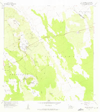
1959 Map of Puu Anahulu
USGS Topo · Published 1975About this map
The Lava Flow of 1859 dominates this landscape, carving a wide path through the volcanic terrain between the districts of North Kona and South Kohala. The high elevation is characterized by a network of cattle-related infrastructure and isolated residences, notably the Puu Waawaa Ranch and the Puu Anahulu Homesteads. A thin line of development follows the Mamalahoa Highway as it winds through the lava fields, connecting clusters of volcanic cones like Puu Panini and Puu Kalaukela.
Find a feature on this map
44 named features on this map. Tap any name to fly to it.
Don’t see what you’re looking for? This feature index may not catch every label — zoom into the map to look around manually.
Map Details
Editions of this 1959 Puu Anahulu Map
2 editions found
Other maps of this area

1927 · Kaohe
USGS Topo · 1:62,500

1928 · Puako
USGS Topo · 1:62,500

1928 · Kailua
USGS Topo · 1:62,500

1930 · Kaohe
USGS Topo · 1:62,500

1954 · Hawaii North
USGS Topo · 1:250,000

1956 · Puu Hinai
USGS Topo · 1:24,000

1956 · Keamuku
USGS Topo · 1:24,000

1956 · Nohonaohae
USGS Topo · 1:24,000

1956 · Naohueleelua
USGS Topo · 1:24,000

1959 · Hawaii North
USGS Topo · 1:250,000