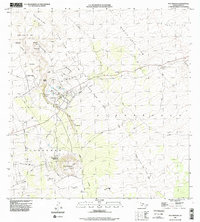
1996 Map of Puu Anahulu
USGS Topo · Published 1998About this map
Lava Flow of 1859 dominates this landscape on the Big Island, carving a path through the Kohala and Kona districts. This mid-century topographic record, updated with 1996 imagery, captures the intersection of volcanic activity and human settlement. The Puu Anahulu Homesteads and the sprawling Puu Waawaa Ranch are central to the region's ranching history, illustrating how local land use adapted to the presence of extensive volcanic fields like the Kaniku Lava Flow.
Find a feature on this map
36 named features on this map. Tap any name to fly to it.
Don’t see what you’re looking for? This feature index may not catch every label — zoom into the map to look around manually.
Map Details
Editions of this 1996 Puu Anahulu Map
2 editions found
Other maps of this area

1927 · Kaohe
USGS Topo · 1:62,500

1928 · Puako
USGS Topo · 1:62,500

1928 · Kailua
USGS Topo · 1:62,500

1930 · Kaohe
USGS Topo · 1:62,500

1954 · Hawaii North
USGS Topo · 1:250,000

1956 · Puu Hinai
USGS Topo · 1:24,000

1956 · Keamuku
USGS Topo · 1:24,000

1956 · Nohonaohae
USGS Topo · 1:24,000

1956 · Naohueleelua
USGS Topo · 1:24,000

1959 · Hawaii North
USGS Topo · 1:250,000