
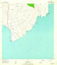
1962 Map of Puu Hou
USGS Topo · Published 1964About this map
The volcanic coastline of the Kahuku district is defined by historical eruptions that reached the Pacific Ocean. This 1962 field-checked survey reveals the stark intersection of geological activity and human habitation, notably where the Lava Flow of 1887 and the Lava Flow of 1868 scarred the terrain near Pakininui. For the researcher, the map identifies specific cultural locations such as the Kahio (Site) and Kailikii (Site), alongside small coastal settlements like Waialua and Hawea. A simple Jeep Trail provides the primary overland access to these points, winding past features like Puu Hou and vital resources like the Water Holes near Haliipalala. The presence of an Indefinite Boundary and various puu, including Puu Waimanalo, highlights the complex topography of this southwestern Hawaii shore.
Find a feature on this map
26 named features on this map. Tap any name to fly to it.
Don’t see what you’re looking for? This feature index may not catch every label — zoom into the map to look around manually.
Map Details
Editions of this 1962 Puu Hou Map
This is the sole edition of this map. No revisions or reprints were ever made.
Other maps of this area

1924 · Kalae
USGS Topo · 1:62,500

1924 · Honuapo
USGS Topo · 1:62,500

1928 · Hoopuloa
USGS Topo · 1:62,500

1954 · Hawaii South
USGS Topo · 1:250,000

1959 · Hawaii South
USGS Topo · 1:250,000

1961 · Hawaii South
USGS Topo · 1:250,000

1962 · Hawaii South
USGS Topo · 1:250,000

1962 · Kahuku Ranch
USGS Topo · 1:24,000

1962 · Pohue Bay
USGS Topo · 1:24,000
1962 · Ka Lae
USGS Topo · 1:24,000