
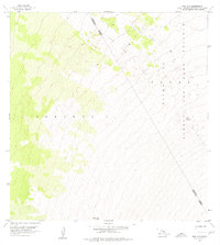
1956 Map of Puu O Uo
USGS Topo · Published 1957About this map
Lava Flow of 1859 dominates this high-elevation landscape on the slopes of Mauna Loa, cutting a wide path across the terrain of Keauhou 2. This mid-1950s survey captures a stark volcanic environment defined by dramatic elevation changes and sparse vegetation. The boundary between the North Kona District and Hamakua District runs through this remote area, which is largely encompassed by the Mauna Loa Game Reserve and Forest Reserve. A single distinctive landmark, the cinder cone of Puu o Uo, sits near the southern edge of the sheet, while the survey station at Kaphe VABM 9307 provides a fixed point of reference in a terrain shaped by relatively recent geologically active processes.
Find a feature on this map
7 named features on this map. Tap any name to fly to it.
Don’t see what you’re looking for? This feature index may not catch every label — zoom into the map to look around manually.
Map Details
Editions of this 1956 Puu O Uo Map
2 editions found
Other maps of this area

1927 · Kaohe
USGS Topo · 1:62,500

1928 · Kailua
USGS Topo · 1:62,500

1928 · Mauna Loa
USGS Topo · 1:62,500

1930 · Kaohe
USGS Topo · 1:62,500

1954 · Hawaii South
USGS Topo · 1:250,000

1954 · Hawaii North
USGS Topo · 1:250,000

1956 · Puu Koli
USGS Topo · 1:24,000
1956 · Kokoolau
USGS Topo · 1:24,000

1956 · Naohueleelua
USGS Topo · 1:24,000

1959 · Hawaii South
USGS Topo · 1:250,000