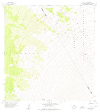
1956 Map of Puu O Uo
USGS Topo · Published 1976About this map
The Lava Flow of 1859 dominates the high-elevation volcanic slopes of Mauna Loa in this mid-century survey. The landscape is defined by its geological recentness, with the dark track of the nineteenth-century eruption cutting a wide path through the Kaohe Game Reserve and towards the Hamakua District and North Kona District boundary. The topography climbs steeply, reaching significant heights at Puu o Uo and Kaphe, markers of the island's massive volcanic structure. This 1950s documentation, later published in the 1970s, captures the high-altitude wilderness of the Keauhou 2 region, where the forest gives way to the barren, historical lava fields that continue to shape the geography of the Big Island.
Find a feature on this map
8 named features on this map. Tap any name to fly to it.
Don’t see what you’re looking for? This feature index may not catch every label — zoom into the map to look around manually.
Map Details
Editions of this 1956 Puu O Uo Map
2 editions found
Other maps of this area

1927 · Kaohe
USGS Topo · 1:62,500

1928 · Kailua
USGS Topo · 1:62,500

1928 · Mauna Loa
USGS Topo · 1:62,500

1930 · Kaohe
USGS Topo · 1:62,500

1954 · Hawaii South
USGS Topo · 1:250,000

1954 · Hawaii North
USGS Topo · 1:250,000

1956 · Puu Koli
USGS Topo · 1:24,000

1956 · Puu O Uo
USGS Topo · 1:24,000
1956 · Kokoolau
USGS Topo · 1:24,000

1956 · Naohueleelua
USGS Topo · 1:24,000