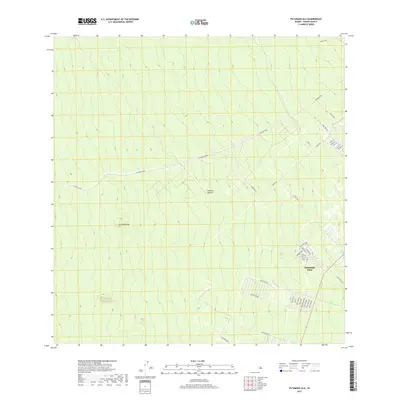
2017 Map of Puumakaala
USGS Topo · Published 2017About this map
Mountain View serves as a primary residential cluster on this part of the Island of Hawai'i, where a grid of local roads meets the expansive terrain rising toward Pu'umaka'ala. The landscape is defined by the long, straight trajectory of the Stainback Hwy, which cuts across the upland slopes, providing a critical transit link through the interior. Further south, the map reveals a burgeoning residential network with street names that pay homage to the broader archipelago, including Maui St, Hawaii St, and Oahu St. The presence of Mauna Kea Dr and Mauna Loa Dr suggests a community planned with an eye toward the island’s famous volcanic geography. This 2017 survey reflects the contemporary balance between residential subdivision development and the preservation of the vast, open forested regions that characterize the windward slopes.
Find a feature on this map
38 named features on this map. Tap any name to fly to it.
Don’t see what you’re looking for? This feature index may not catch every label — zoom into the map to look around manually.
Map Details
Editions of this 2017 Puumakaala Map
This is the sole edition of this map. No revisions or reprints were ever made.
Other maps of this area

1917 · Hilo
USGS Topo · 1:62,500

1921 · Kilauea
USGS Topo · 1:62,500

1922 · Puna
USGS Topo · 1:62,500

1924 · Kilauea
USGS Topo · 1:62,500

1924 · Puna
USGS Topo · 1:62,500

1930 · Humuula
USGS Topo · 1:62,500

1932 · Hilo
USGS Topo · 1:62,500

1954 · Hawaii South
USGS Topo · 1:250,000

1954 · Hawaii North
USGS Topo · 1:250,000

1956 · Upper Piihonua
USGS Topo · 1:24,000