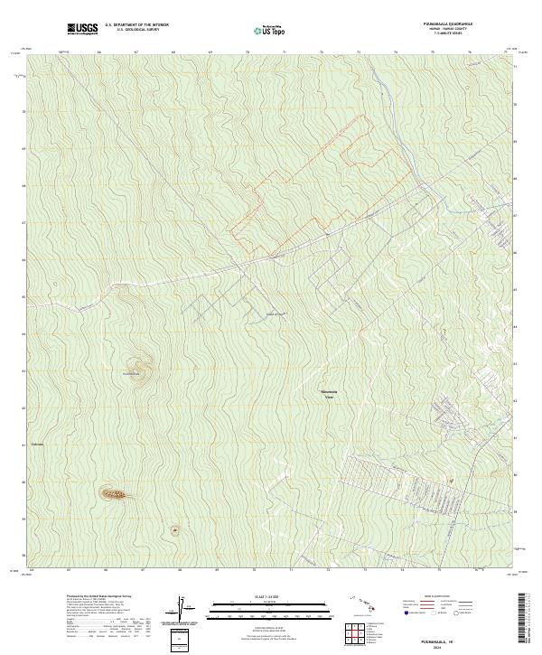
2024 Map of Puumakaala
USGS Topo · Published 2024About this map
The Hawai'i Volcanoes Wilderness dominates the southwestern corner of this survey, illustrating the protected volcanic terrain of the Island of Hawai'i. The map details the residential and agricultural layout of Mountain View, where a dense network of roads such as Mauna Kea Dr and Kaawale Blvd shows the modern expansion of these communities along the slopes. Significant topographic detail is captured around Pu'umaka'ala, revealing the steep contouring of the landscape as it rises toward the volcanic peaks. Major transit corridors, including the Stainback Hwy and the Hawaii Belt Rd, provide context for the region's connectivity between the coastal hubs and the interior highlands. This edition serves as a precise record of contemporary Hawaiian land use, from the quiet fringes of Volcano to the named residential streets of the island's eastern rift zone.
Find a feature on this map
48 named features on this map. Tap any name to fly to it.
Don’t see what you’re looking for? This feature index may not catch every label — zoom into the map to look around manually.
Map Details
Editions of this 2024 Puumakaala Map
This is the sole edition of this map. No revisions or reprints were ever made.
Other maps of this area

1917 · Hilo
USGS Topo · 1:62,500

1921 · Kilauea
USGS Topo · 1:62,500

1922 · Puna
USGS Topo · 1:62,500

1924 · Kilauea
USGS Topo · 1:62,500

1924 · Puna
USGS Topo · 1:62,500

1930 · Humuula
USGS Topo · 1:62,500

1932 · Hilo
USGS Topo · 1:62,500

1954 · Hawaii South
USGS Topo · 1:250,000

1954 · Hawaii North
USGS Topo · 1:250,000

1956 · Upper Piihonua
USGS Topo · 1:24,000