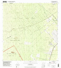
1994 Map of Puumakaala
USGS Topo · Published 2002About this map
Pu'umaka'ala rises as a prominent landmark within this high-elevation tropical landscape on the Big Island. The map documents a transition between organized human settlement and protected wilderness, notably where Waiākea Homesteads and the 'Ōla'a Reservation Lots meet the dense vegetation of the 'Ōla'a Forest Reserve. A complex network of transit history is visible here, from the modern Stainback Highway to the legacy of the timber and sugar industries represented by a Railroad Grade and Old Railroad Grade.
Find a feature on this map
24 named features on this map. Tap any name to fly to it.
Don’t see what you’re looking for? This feature index may not catch every label — zoom into the map to look around manually.
Map Details
Editions of this 1994 Puumakaala Map
This is the sole edition of this map. No revisions or reprints were ever made.
Other maps of this area

1917 · Hilo
USGS Topo · 1:62,500

1921 · Kilauea
USGS Topo · 1:62,500

1922 · Puna
USGS Topo · 1:62,500

1924 · Kilauea
USGS Topo · 1:62,500

1924 · Puna
USGS Topo · 1:62,500

1930 · Humuula
USGS Topo · 1:62,500

1932 · Hilo
USGS Topo · 1:62,500

1954 · Hawaii South
USGS Topo · 1:250,000

1954 · Hawaii North
USGS Topo · 1:250,000

1956 · Upper Piihonua
USGS Topo · 1:24,000