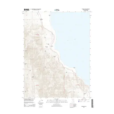
2014 Map of Pyramid SW
USGS Topo · Published 2014About this map
Pyramid Lake defines the eastern half of this landscape, its waters meeting a shoreline punctuated by landmarks such as Wizards Beach and Warrior Point. Rising sharply from the western shore, the Virginia Mountains dominate the terrain with a network of steep drainages including Jigger Bobb Canyon, Thunderbolt Canyon, and Poison Canyon. This 2014 survey documents a rugged, high-desert environment where water sources like Hornet Spring and Barrel Spring provide critical relief in an otherwise arid expanse. The settlement of Pyramid sits at the base of the mountains along the Pyramid Lake Rd, serving as a primary transit point. Notable landforms like George Washington Rock and the high Tule Ridge reflect the geological complexity of the Great Basin, while the intricate contour lines illustrate the dramatic vertical relief between the lake and the mountain summits.
Find a feature on this map
25 named features on this map. Tap any name to fly to it.
Don’t see what you’re looking for? This feature index may not catch every label — zoom into the map to look around manually.
Map Details
Editions of this 2014 Pyramid SW Map
This is the sole edition of this map. No revisions or reprints were ever made.
Other maps of this area

1886 · Granite Range
USGS Topo · 1:250,000

1891 · Reno
USGS Topo · 1:125,000

1893 · Reno
USGS Topo · 1:125,000

1894 · Granite Range
USGS Topo · 1:250,000

1955 · Lovelock
USGS Topo · 1:250,000

1957 · Sutcliffe
USGS Topo · 1:62,500

1957 · Dogskin Mountain
USGS Topo · 1:62,500

1957 · Reno
USGS Topo · 1:250,000

1959 · Lovelock
USGS Topo · 1:250,000

1959 · Reno
USGS Topo · 1:250,000