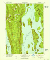
1952 Map of Quabbin Reservoir
USGS Topo · Published 1953About this map
Quabbin Reservoir dominates this 1952 topographic study, showing the engineered landscape of Central Massachusetts as it appeared just over a decade after its filling was completed. The map details the complex topography of the islands and surrounding ridges that survived the flooding, including Soapstone Hill, Mount L, and Russ Mtn. The peninsula formed by Prescott Hill and Mt Pleasant extends deep into the reservoir, preserving the remnants of earlier roads and settlements that were displaced by the metropolitan water project.
Find a feature on this map
26 named features on this map. Tap any name to fly to it.
Don’t see what you’re looking for? This feature index may not catch every label — zoom into the map to look around manually.
Map Details
Editions of this 1952 Quabbin Reservoir Map
3 editions found
Other maps of this area

1887 · Warwick
USGS Topo · 1:62,500

1887 · Belchertown
USGS Topo · 1:62,500

1887 · Winchendon
USGS Topo · 1:62,500

1887 · Barre
USGS Topo · 1:62,500

1889 · Barre
USGS Topo · 1:62,500

1889 · Warwick
USGS Topo · 1:62,500

1890 · Belchertown
USGS Topo · 1:62,500

1890 · Winchendon
USGS Topo · 1:62,500

1893 · Belchertown
USGS Topo · 1:62,500

1894 · Winchendon
USGS Topo · 1:62,500