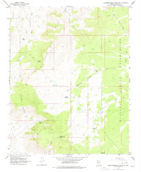
1968 Map of Quartermaster Canyon
USGS Topo · Published 1979About this map
The Grand Wash Cliffs dominate this portion of Mohave County, where the high plateaus of the Hualapai Indian Reservation drop away toward the Grand Wash. The map documents a landscape defined by water scarcity and cattle ranching infrastructure, noted by the many tanks and springs scattered across the high desert terrain. Notable water sources include Honeymoon Tank, Cedar Spring, and Hells Canyon Spring, providing essential points for livestock in an arid environment. A network of jeep trails and a prominent pipeline traverse the western slopes, connecting landmarks like Duncan and various unnamed prospects. The inclusion of Lost Creek Reservoir and Topside Reservoir suggests mid-century efforts to manage seasonal runoff from the surrounding peaks and canyons.
Find a feature on this map
25 named features on this map. Tap any name to fly to it.
Don’t see what you’re looking for? This feature index may not catch every label — zoom into the map to look around manually.
Map Details
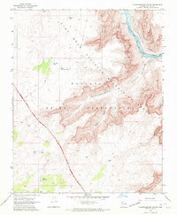
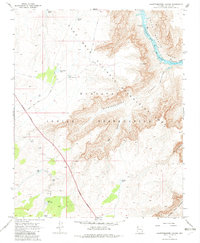
Editions of this 1968 Quartermaster Canyon Map
3 editions found
Other maps of this area

1886 · Diamond Creek
USGS Topo · 1:250,000

1886 · Mt. Trumbull
USGS Topo · 1:250,000

1892 · Diamond Creek
USGS Topo · 1:250,000

1892 · Mt. Trumbull
USGS Topo · 1:250,000

1948 · Williams
USGS Topo · 1:250,000

1953 · Grand Canyon
USGS Topo · 1:250,000

1954 · Williams
USGS Topo · 1:250,000

1956 · Williams
USGS Topo · 1:250,000

1957 · Grand Canyon
USGS Topo · 1:250,000

1958 · Grand Canyon
USGS Topo · 1:250,000