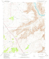
1968 Map of Quartermaster Canyon
USGS Topo · Published 1982About this map
Lower Granite Gorge forms the dramatic centerpiece of this late-1960s survey, where the Colorado River carves through deep canyon walls. This specific reach includes Wards Cave Rapids and a marked Waterfall, emphasizing the river's character before it reaches the full extent of Lake Mead. The map reveals a strict divide between the Hualapai Indian Reservation and the Lake Mead National Recreation Area, with an Indefinite Boundary tracking the high plateau above Quartermaster Canyon. Human presence is minimal, defined primarily by survival infrastructure like Granite Tank, Smith Tank, and New Water Tank. Access to the rim is limited to the Buck and Doe Road and a solitary Jeep Trail, leading to the Quartermaster View Point overlooking the immense verticality of Jeff Canyon.
Find a feature on this map
26 named features on this map. Tap any name to fly to it.
Don’t see what you’re looking for? This feature index may not catch every label — zoom into the map to look around manually.
Map Details
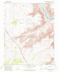
Editions of this 1968 Quartermaster Canyon Map
3 editions found
Other maps of this area

1886 · Diamond Creek
USGS Topo · 1:250,000

1886 · Mt. Trumbull
USGS Topo · 1:250,000

1892 · Diamond Creek
USGS Topo · 1:250,000

1892 · Mt. Trumbull
USGS Topo · 1:250,000

1948 · Williams
USGS Topo · 1:250,000

1953 · Grand Canyon
USGS Topo · 1:250,000

1954 · Williams
USGS Topo · 1:250,000

1956 · Williams
USGS Topo · 1:250,000

1957 · Grand Canyon
USGS Topo · 1:250,000

1958 · Grand Canyon
USGS Topo · 1:250,000