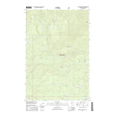
2017 Map of Quartz Creek Butte
USGS Topo · Published 2017About this map
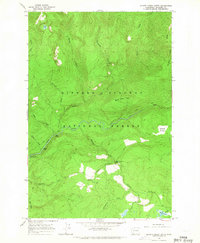
Gifford Pinchot National Forest dominates this mountain landscape, which is defined by a dense network of watercourses and forest development roads. The Lewis River flows through the central portion of the map, fed by numerous tributaries including Tillieum Cr, Strawberry Cr, and Quartz Cr. Notable hydrological features include Little Niagara Falls and Upper Falls, as well as the high-altitude Blue Lake in the northwest corner. This area serves as a critical corridor for outdoor navigation, highlighted by the presence of the Pacific Crest National Scenic Trail as it traverses the southern section near Big Mosquito Lake. The terrain is marked by significant elevations like Quartz Creek Butte and Quartz Creek Ridge, while Surprise Meadow provides a distinct break in the forested canopy. The extensive system of National Forest Development Roads illustrates the modern management and accessibility of this remote timber and recreation region.
Find a feature on this map
41 named features on this map. Tap any name to fly to it.
Don’t see what you’re looking for? This feature index may not catch every label — zoom into the map to look around manually.
Map Details
Editions of this 2017 Quartz Creek Butte Map
This is the sole edition of this map. No revisions or reprints were ever made.
Other maps of this area

1926 · Steamboat Mtn
USGS Topo · 1:125,000

1931 · Steamboat Mtn
USGS Topo · 1:125,000

1950 · Yakima
USGS Topo · 1:250,000

1958 · Yakima
USGS Topo · 1:250,000

1961 · Yakima
USGS Topo · 1:250,000
1965 · Burnt Peak
USGS Topo · 1:24,000
1965 · Lone Butte
USGS Topo · 1:24,000
1965 · Spencer Butte
USGS Topo · 1:24,000
1965 · Quartz Creek Butte
USGS Topo · 1:24,000
1965 · Mc Coy Peak
USGS Topo · 1:24,000