
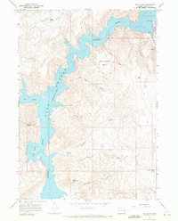
1967 Map of Quartz Mtn Basin
USGS Topo · Published 1971About this map
The Quartz Mtn Basin reveals a remote Malheur County landscape in the late 1960s, defined by its critical water sources and livestock outposts. Evidence of ranching and seasonal grazing is clear at Morcom Cow Camp and Eddy Place, which are supported by numerous named water points including Mattingly Spring, Diamond Spring, and Daly Spring. The terrain transitions from the low-lying Sand Hills in the north toward the higher elevations of Quartz Mountain and Black Butte to the south. Geologic features like Acton Gulch and Deadman Gulch cut through the eastern hills, while a solitary Prospect and a rugged Jeep Trail hint at the area's isolation and limited industrial activity. The mapping of Homestead Reservoir underscores the importance of water management in this arid stretch of eastern Oregon.
Find a feature on this map
21 named features on this map. Tap any name to fly to it.
Don’t see what you’re looking for? This feature index may not catch every label — zoom into the map to look around manually.
Map Details
Editions of this 1967 Quartz Mtn Basin Map
This is the sole edition of this map. No revisions or reprints were ever made.
Other maps of this area

1906 · Mitchell Butte
USGS Topo · 1:125,000

1955 · Boise
USGS Topo · 1:250,000

1958 · Boise
USGS Topo · 1:250,000

1962 · Boise
USGS Topo · 1:250,000

1967 · Pelican Point
USGS Topo · 1:24,000

1967 · Diamond Butte
USGS Topo · 1:24,000
1967 · The Elbow
USGS Topo · 1:24,000

1967 · Twin Springs
USGS Topo · 1:24,000

1967 · Rooster Comb
USGS Topo · 1:24,000

1972 · Big Mud Flat
USGS Topo · 1:24,000