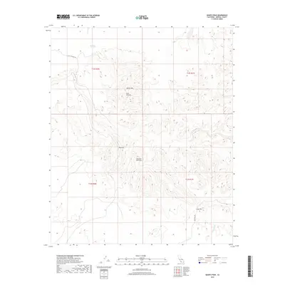
2018 Map of Quartz Peak
USGS Topo · Published 2018About this map
Chocolate Mountains dominates the landscape of this Imperial County desert terrain, where early 21st-century topography highlights the importance of water and passage. The presence of Peter Kane Water Hole and the drainage of Indian Wash illustrate the scarce hydrological features essential for navigation and survival in this arid region. High points such as Quartz Peak, Peter Kane Mtn, and Black Mtn provide significant landmarks for survey and orientation. Human infrastructure is minimal, represented by the unpaved routes of Black Mountain Rd and Indian Pass Rd, which converge near Indian Pass. This 2018 survey captures the primitive nature of these desert corridors, marking the enduring topography of the Public Land Survey System grids before they give way to the more developed areas of the Colorado Desert.
Find a feature on this map
13 named features on this map. Tap any name to fly to it.
Don’t see what you’re looking for? This feature index may not catch every label — zoom into the map to look around manually.
Map Details
Editions of this 2018 Quartz Peak Map
This is the sole edition of this map. No revisions or reprints were ever made.
Other maps of this area

1903 · Yuma
USGS Topo · 1:125,000

1905 · Yuma
USGS Topo · 1:125,000

1942 · Yuma
USGS Topo · 1:250,000

1942 · Blythe
USGS Topo · 1:250,000

1945 · Picacho Peak
USGS Topo · 1:62,500

1945 · Picacho
USGS Topo · 1:62,500

1951 · Picacho
USGS Topo · 1:62,500

1951 · Picacho Peak
USGS Topo · 1:62,500

1953 · Quartz Peak
USGS Topo · 1:62,500

1953 · Ogilby
USGS Topo · 1:62,500