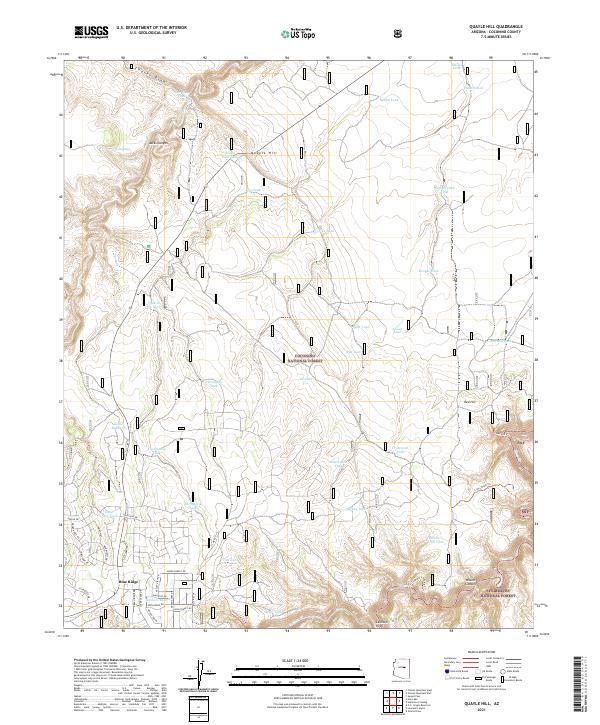
2021 Map of Quayle Hill
USGS Topo · Published 2021About this map
Coconino National Forest and Sitgreaves National Forest meet in this high-altitude landscape of the Mogollon Rim country. The settlement of Blue Ridge anchors the southwest corner, showing a dense residential street network including Starlight Dr and Knollwood Dr that contrasts with the surrounding wilderness. The terrain is defined by dramatic changes in elevation, from the heights of Quayle Hill and Red Hill to the deep incisions of Jacks Canyon and Wilkins Canyon.
Find a feature on this map
67 named features on this map. Tap any name to fly to it.
Don’t see what you’re looking for? This feature index may not catch every label — zoom into the map to look around manually.
Map Details
Editions of this 2021 Quayle Hill Map
This is the sole edition of this map. No revisions or reprints were ever made.
Other maps of this area

1886 · Holbrook
USGS Topo · 1:250,000

1887 · Verde
USGS Topo · 1:250,000

1892 · Verde
USGS Topo · 1:250,000

1893 · Holbrook
USGS Topo · 1:250,000

1954 · Holbrook
USGS Topo · 1:250,000

1955 · Sunset Knoll 2 SW
USGS Topo · 1:24,000

1955 · Sunset Pass
USGS Topo · 1:62,500

1957 · Holbrook
USGS Topo · 1:250,000

1958 · Holbrook
USGS Topo · 1:250,000

1960 · Holbrook
USGS Topo · 1:250,000