
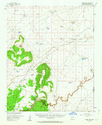
1955 Map of Sunset Pass
USGS Topo · Published 1958About this map
West Sunset Mountain and East Sunset Mountain dominate this central Arizona landscape, flanking the gap known as Sunset Pass. The survey documents a semi-arid ranching and utility environment characterized by a vast network of water infrastructure, including numerous stock tanks like Rowlan Tank, Hobo Tank, and the larger Moonlight Bay Reservoir. The northern portion of the map identifies the Winslow Municipal Well Field and the Toltec Divide, indicating the area's importance for regional water resources.
Find a feature on this map
32 named features on this map. Tap any name to fly to it.
Don’t see what you’re looking for? This feature index may not catch every label — zoom into the map to look around manually.
Map Details
Editions of this 1955 Sunset Pass Map
2 editions found
Other maps of this area

1883 · Tusayan
USGS Topo · 1:250,000

1886 · Tusayan
USGS Topo · 1:250,000

1886 · San Francisco Mtns
USGS Topo · 1:250,000

1886 · Holbrook
USGS Topo · 1:250,000

1887 · Verde
USGS Topo · 1:250,000

1891 · San Francisco Mtns
USGS Topo · 1:250,000

1892 · Verde
USGS Topo · 1:250,000

1893 · Holbrook
USGS Topo · 1:250,000

1894 · San Francisco Mtns
USGS Topo · 1:250,000

1899 · San Francisco Mtns
USGS Topo · 1:250,000