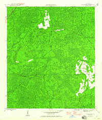
1946 Map of Queens Bay
USGS Topo · Published 1960About this map
The Apalachicola National Forest dominates this mid-1940s landscape in Liberty County, Florida, where dense wetlands and intricate waterways create a complex natural geography. The Apalachicola Northern railroad cuts through the northwestern corner of the sheet, providing a vital industrial link through this heavily wooded region. The terrain is characterized by numerous island formations within the swampy lowlands, most notably the Black Cat Islands and Indian Creek Islands.
Find a feature on this map
11 named features on this map. Tap any name to fly to it.
Don’t see what you’re looking for? This feature index may not catch every label — zoom into the map to look around manually.
Map Details
Editions of this 1946 Queens Bay Map
3 editions found
Other maps of this area

1943 · Lake Talquin
USGS Topo · 1:62,500

1944 · Queens Bay
USGS Topo · 1:24,000

1945 · Thousand Yard Bay
USGS Topo · 1:31,680

1945 · Smith Creek
USGS Topo · 1:31,680

1945 · Woods
USGS Topo · 1:31,680

1945 · Telogia
USGS Topo · 1:24,000

1946 · Queens Bay
USGS Topo · 1:31,680

1946 · Sumatra
USGS Topo · 1:31,680

1946 · Telogia
USGS Topo · 1:31,680

1946 · Owens Bridge
USGS Topo · 1:31,680