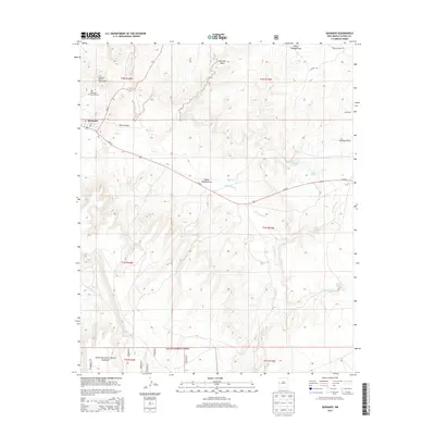
2013 Map of Quemado
USGS Topo · Published 2013About this map
Quemado serves as the primary hub of this high-altitude landscape in western New Mexico, situated along Us-60 E. The settlement is anchored by the Quemado District Ranger Office and includes the Quemado Community Cem, providing a clear record of local genealogy and civic presence. To the north, the dramatic plateau of Mariano Mesa overlooks a series of drainage systems, including Wilbur Wadley Draw and Baca Arroyo.
Find a feature on this map
29 named features on this map. Tap any name to fly to it.
Don’t see what you’re looking for? This feature index may not catch every label — zoom into the map to look around manually.
Map Details
Editions of this 2013 Quemado Map
This is the sole edition of this map. No revisions or reprints were ever made.
Other maps of this area

1954 · Saint Johns
USGS Topo · 1:250,000

1957 · Saint Johns
USGS Topo · 1:250,000

1958 · Saint Johns
USGS Topo · 1:250,000

1962 · Saint Johns
USGS Topo · 1:250,000

1967 · Omega
USGS Topo · 1:24,000

1967 · Mariano Springs
USGS Topo · 1:24,000

1967 · Adams Diggings
USGS Topo · 1:24,000

1967 · Quemado
USGS Topo · 1:24,000

1972 · Tejana Mesa
USGS Topo · 1:24,000
1972 · Armstrong Canyon
USGS Topo · 1:24,000