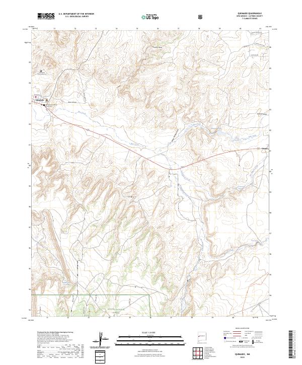
2023 Map of Quemado
USGS Topo · Published 2023About this map
Quemado sits as the primary crossroads in this high-desert landscape, where the local heritage is anchored by the Quemado Community Cem and the Sacred Heart Catholic Church Cem. The terrain is defined by a network of seasonal watercourses and prominent landforms such as Mariano Mesa and Signal Butte. As the landscape transitions south, the survey enters the Apache National Forest, a region marked by numerous springs including Nutria Spring and San Ignacio Spring. The eastern edge of the quadrangle is traversed by the Continental Divide National Scenic Trail, illustrating the rugged, high-elevation character of Catron County. Significant water features like Sweazea Lake and Rito Creek drain the surrounding arroyos, while the small settlement of Omega punctuates the eastern corridor.
Find a feature on this map
31 named features on this map. Tap any name to fly to it.
Don’t see what you’re looking for? This feature index may not catch every label — zoom into the map to look around manually.
Map Details
Editions of this 2023 Quemado Map
This is the sole edition of this map. No revisions or reprints were ever made.
Other maps of this area

1954 · Saint Johns
USGS Topo · 1:250,000

1957 · Saint Johns
USGS Topo · 1:250,000

1958 · Saint Johns
USGS Topo · 1:250,000

1962 · Saint Johns
USGS Topo · 1:250,000

1967 · Omega
USGS Topo · 1:24,000

1967 · Mariano Springs
USGS Topo · 1:24,000

1967 · Adams Diggings
USGS Topo · 1:24,000

1967 · Quemado
USGS Topo · 1:24,000

1972 · Tejana Mesa
USGS Topo · 1:24,000
1972 · Armstrong Canyon
USGS Topo · 1:24,000