
1983 Map of Quick Reservoir
USGS Topo · Published 1983About this map
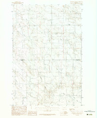
Mc Cune Creek and Heil Creek carve through this Montana landscape, which is defined by a complex network of drainage basins and high ridges. The area represents the remote ranching and grazing lands of McCone County as they were documented in the late 1970s. The presence of the Quick Reservoir in the northeastern quadrant suggests the importance of water management in this arid environment, providing a focal point for livestock or local irrigation.
Find a feature on this map
8 named features on this map. Tap any name to fly to it.
Don’t see what you’re looking for? This feature index may not catch every label — zoom into the map to look around manually.
Map Details
Editions of this 1983 Quick Reservoir Map
This is the sole edition of this map. No revisions or reprints were ever made.
Other maps of this area

1954 · Glendive
USGS Topo · 1:250,000

1957 · Glendive
USGS Topo · 1:250,000

1958 · Glendive
USGS Topo · 1:250,000

1982 · Circle
USGS Topo · 1:100,000

1983 · Youngquist Mine
USGS Topo · 1:24,000

1983 · Woodworth Hill
USGS Topo · 1:24,000

1983 · Mount Antelope
USGS Topo · 1:24,000

1983 · Circle
USGS Topo · 1:24,000
1983 · Bearshack Creek
USGS Topo · 1:24,000
1983 · Big Sheep Mountain NW
USGS Topo · 1:24,000