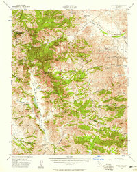
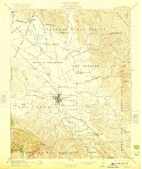
1956 Map of Quien Sabe
USGS Topo · Published 1958About this map
Quien Sabe Valley and the surrounding high country of the Diablo Range define this 1950s survey of the Merced and San Benito County border. The landscape is dominated by a complex network of cattle ranches, including the Quien Sabe Ranch, Cleveland Ranch, and Buena Vista Ranch, situated along the winding courses of Quien Sabe Creek and Santa Ana Creek. This era of land use is clearly marked by the presence of Schoolhouse Ridge and the Quien Sabe Reservoir, which provided vital water infrastructure to the interior valleys.
Find a feature on this map
58 named features on this map. Tap any name to fly to it.
Don’t see what you’re looking for? This feature index may not catch every label — zoom into the map to look around manually.
Map Details
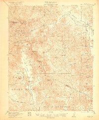
Editions of this 1956 Quien Sabe Map
2 editions found

Other maps of this area

1913 · Panoche
USGS Topo · 1:125,000

1919 · San Benito
USGS Topo · 1:62,500

1919 · Hollister
USGS Topo · 1:48,000

1920 · Pacheco Pass
USGS Topo · 1:62,500

1920 · Carrisalito Spring
USGS Topo · 1:31,680
1921 · Volta
USGS Topo · 1:31,680
1921 · Gonzales
USGS Topo · 1:62,500
1921 · Gilroy Hot Springs
USGS Topo · 1:62,500
1921 · Hollister
USGS Topo · 1:62,500
1922 · Quien Sabe
USGS Topo · 1:62,500