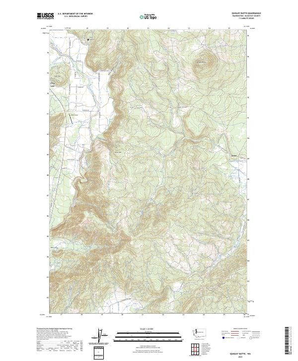
2023 Map of Quigley Butte
USGS Topo · Published 2023About this map
Trout Lake Valley and the surrounding highlands of Klickitat County are mapped here in the early 2020s, showing a landscape defined by volcanic peaks and significant conservation areas. The eastern portion of the map is dominated by the Conboy Lake National Wildlife Refuge, where Holmes Creek and Outlet Creek traverse the wetland terrain. Near the settlement of Laurel, the land transitions from the refuge into the foothills of Quigley Butte. To the west, the White Salmon River flows past Little Mtn and the small mountain town of Trout Lake. Local history is preserved at the Trout Lake Cem, while the geography is punctuated by several prominent landforms including Gross Mtn and the dramatic incisions of Stoller Canyon and Elmer Canyon.
Find a feature on this map
55 named features on this map. Tap any name to fly to it.
Don’t see what you’re looking for? This feature index may not catch every label — zoom into the map to look around manually.
Map Details
Editions of this 2023 Quigley Butte Map
This is the sole edition of this map. No revisions or reprints were ever made.
Other maps of this area

1904 · Mount Adams
USGS Topo · 1:125,000

1907 · Mount Adams
USGS Topo · 1:125,000

1926 · Steamboat Mtn
USGS Topo · 1:125,000

1926 · Hood River
USGS Topo · 1:125,000

1929 · Hood River
USGS Topo · 1:125,000

1931 · Steamboat Mtn
USGS Topo · 1:125,000

1934 · The Dalles
USGS Topo · 1:125,000

1950 · Yakima
USGS Topo · 1:250,000

1953 · The Dalles
USGS Topo · 1:250,000

1956 · The Dalles
USGS Topo · 1:250,000