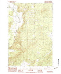
1983 Map of Quigley Butte
USGS Topo · Published 1983About this map
The White Salmon River cuts through the western edge of this 1979 field-checked landscape, defining the transition from the irrigated Trout Lake Valley to the higher elevations of the Yakima Indian Reservation. A complex network of irrigation ditches in the valley floor contrasts with the more natural drainage of Hangman Creek and Chapman Creek to the east. Small communities like Holmes and Laurel are situated near the edge of the Conboy Lake National Wildlife Refuge, which preserves the wetlands of Camas Prairie.
Find a feature on this map
24 named features on this map. Tap any name to fly to it.
Don’t see what you’re looking for? This feature index may not catch every label — zoom into the map to look around manually.
Map Details
Editions of this 1983 Quigley Butte Map
This is the sole edition of this map. No revisions or reprints were ever made.
Other maps of this area

1904 · Mount Adams
USGS Topo · 1:125,000

1907 · Mount Adams
USGS Topo · 1:125,000

1926 · Steamboat Mtn
USGS Topo · 1:125,000

1926 · Hood River
USGS Topo · 1:125,000

1929 · Hood River
USGS Topo · 1:125,000

1931 · Steamboat Mtn
USGS Topo · 1:125,000

1934 · The Dalles
USGS Topo · 1:125,000

1950 · Yakima
USGS Topo · 1:250,000

1953 · The Dalles
USGS Topo · 1:250,000

1956 · The Dalles
USGS Topo · 1:250,000