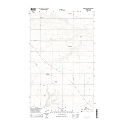
2014 Map of Quigley Coulee
USGS Topo · Published 2014About this map
Grainbelt Cem stands as a focal point for family researchers in this high-plains landscape of northern Montana. The topography is defined by a dense network of coulees—dry creek beds that channel seasonal runoff toward the Milk River valley—including Quigley Coulee, Lohman Coulee, and Supenau Coulee. These features create a repetitive, branching landform pattern characteristic of the region's semi-arid erosion.
Find a feature on this map
30 named features on this map. Tap any name to fly to it.
Don’t see what you’re looking for? This feature index may not catch every label — zoom into the map to look around manually.
Map Details
Editions of this 2014 Quigley Coulee Map
This is the sole edition of this map. No revisions or reprints were ever made.
Other maps of this area

1904 · Havre
USGS Topo · 1:62,500

1904 · Assinniboine
USGS Topo · 1:62,500

1912 · Thibedeau Lake
USGS Topo · 1:125,000

1953 · Havre
USGS Topo · 1:250,000

1957 · Havre
USGS Topo · 1:250,000

1958 · Havre
USGS Topo · 1:250,000

1964 · Havre NW
USGS Topo · 1:24,000

1964 · Havre
USGS Topo · 1:24,000
1970 · Herron Park
USGS Topo · 1:24,000
1970 · Quigley Coulee
USGS Topo · 1:24,000