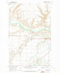
1970 Map of Herron Park
USGS Topo · Published 1973About this map
The Milk River carves a winding path through the northern plains of Montana, defining a landscape of erosion and industry in this 1970s survey. The map centers on the historical significance of the Agricultural Experiment Station (Fort Assinniboine Site), highlighting the region's long-standing transition from military frontier to agricultural research. The surrounding terrain is marked by the complex drainage of numerous coulees, such as Davenport Coulee and Rattlesnake Coulee, which cut through the northern Badlands.
Find a feature on this map
37 named features on this map. Tap any name to fly to it.
Don’t see what you’re looking for? This feature index may not catch every label — zoom into the map to look around manually.
Map Details
Editions of this 1970 Herron Park Map
2 editions found
Other maps of this area

1904 · Havre
USGS Topo · 1:62,500

1904 · Assinniboine
USGS Topo · 1:62,500

1912 · Thibedeau Lake
USGS Topo · 1:125,000

1953 · Havre
USGS Topo · 1:250,000

1957 · Havre
USGS Topo · 1:250,000

1958 · Havre
USGS Topo · 1:250,000

1959 · Laredo
USGS Topo · 1:62,500

1959 · Shambo
USGS Topo · 1:62,500

1964 · Havre NW
USGS Topo · 1:24,000

1964 · Havre
USGS Topo · 1:24,000