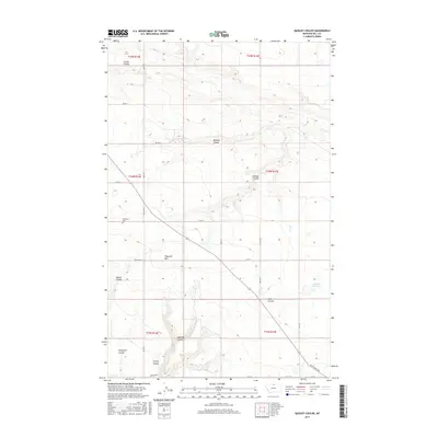
2017 Map of Quigley Coulee
USGS Topo · Published 2017About this map
Quigley Coulee and its neighboring drainages define this high-plains landscape in Hill County, where the terrain is marked by deep coulees and isolated peaks. The map reveals a remote ranching and farming region structured by an orderly grid of section lines and gravel roads, including Fresno Rd N and the historically named Wild Horse Trl. Significant local markers for genealogists and historians include the Grainbelt Cem, located near the intersection of Rd 80 N and Co Rd 415 N. The southern portion of the quadrangle is dominated by the complex drainage systems of Supenau Coulee and Cherry Coulee, while the eastern side features the Lohman Reservoir. This 2017 survey reflects the enduring rural character of North-Central Montana, showing how water management and terrain such as Flagstaff Hill continue to dictate the placement of local infrastructure and land use.
Find a feature on this map
29 named features on this map. Tap any name to fly to it.
Don’t see what you’re looking for? This feature index may not catch every label — zoom into the map to look around manually.
Map Details
Editions of this 2017 Quigley Coulee Map
This is the sole edition of this map. No revisions or reprints were ever made.
Other maps of this area

1904 · Havre
USGS Topo · 1:62,500

1904 · Assinniboine
USGS Topo · 1:62,500

1912 · Thibedeau Lake
USGS Topo · 1:125,000

1953 · Havre
USGS Topo · 1:250,000

1957 · Havre
USGS Topo · 1:250,000

1958 · Havre
USGS Topo · 1:250,000

1964 · Havre NW
USGS Topo · 1:24,000

1964 · Havre
USGS Topo · 1:24,000
1970 · Herron Park
USGS Topo · 1:24,000
1970 · Quigley Coulee
USGS Topo · 1:24,000