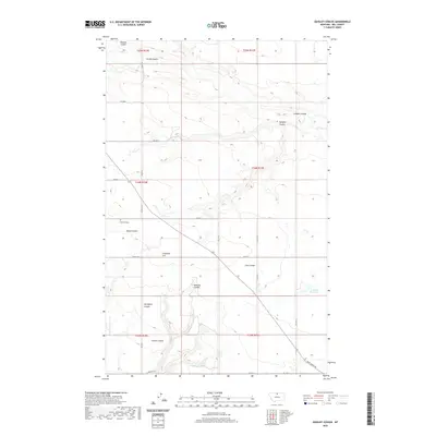
2020 Map of Quigley Coulee
USGS Topo · Published 2020About this map
Grainbelt Cem and Flagstaff Hill stand as prominent landmarks in this section of Hill County, where the high plains are deeply dissected by a network of drainage channels. The landscape is defined by its coulees, ranging from the northern Redrock Coulee and Carske Coulee to Cherry Coulee and Davenport Coulee in the south. These features reveal the intricate natural drainage system directed toward the Lohman Reservoir in the eastern reaches of the quadrangle.
Find a feature on this map
25 named features on this map. Tap any name to fly to it.
Don’t see what you’re looking for? This feature index may not catch every label — zoom into the map to look around manually.
Map Details
Editions of this 2020 Quigley Coulee Map
This is the sole edition of this map. No revisions or reprints were ever made.
Other maps of this area

1904 · Havre
USGS Topo · 1:62,500

1904 · Assinniboine
USGS Topo · 1:62,500

1912 · Thibedeau Lake
USGS Topo · 1:125,000

1953 · Havre
USGS Topo · 1:250,000

1957 · Havre
USGS Topo · 1:250,000

1958 · Havre
USGS Topo · 1:250,000

1964 · Havre NW
USGS Topo · 1:24,000

1964 · Havre
USGS Topo · 1:24,000
1970 · Herron Park
USGS Topo · 1:24,000
1970 · Quigley Coulee
USGS Topo · 1:24,000