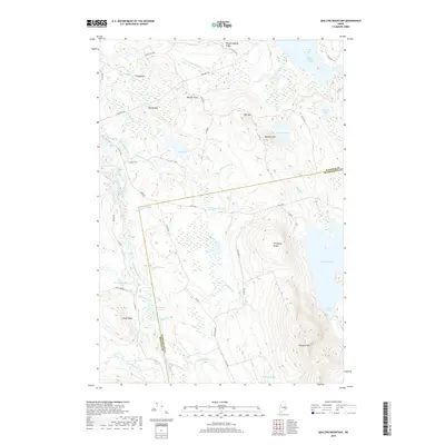
2018 Map of Quillpig Mountain
USGS Topo · Published 2018About this map
The Narraguagus River winds through the western reaches of this landscape, carving out The Oxbow near Oxbow Mtn. This Maine interior is defined by its significant water bodies and the logging infrastructure that connects them. Lower Sabao Lake and Mopang Lake dominate the eastern topography, while the central terrain is marked by prominent elevations like Quillpig Mtn and the long spine of Thirtyfive Ridge.
Find a feature on this map
59 named features on this map. Tap any name to fly to it.
Don’t see what you’re looking for? This feature index may not catch every label — zoom into the map to look around manually.
Map Details
Editions of this 2018 Quillpig Mountain Map
This is the sole edition of this map. No revisions or reprints were ever made.
Other maps of this area

1929 · Lead Mountain
USGS Topo · 1:48,000

1932 · Nicatous Lake
USGS Topo · 1:48,000

1932 · Lead Mountain
USGS Topo · 1:62,500

1934 · Nicatous Lake
USGS Topo · 1:62,500

1941 · Tug Mountain
USGS Topo · 1:62,500

1941 · Wabassus Lake
USGS Topo · 1:62,500

1943 · Tug Mountain
USGS Topo · 1:62,500

1943 · Wabassus Lake
USGS Topo · 1:62,500

1948 · Bangor
USGS Topo · 1:250,000

1953 · Wabassus Lake
USGS Topo · 1:62,500