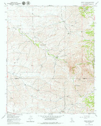
1965 Map of Quincy School
USGS Topo · Published 1979About this map
The Old Stockton Los Angeles Stage Road winds through this Central Valley landscape, tracing a historical transportation corridor that once linked California's north and south. The map centers on a region defined by seasonal drainage patterns and ranching infrastructure, such as Flynn Ranch and Vincent Ranch. A notable point of local history is the Quincy Sch (Site), marking the former location of a rural schoolhouse along the White River.
Find a feature on this map
19 named features on this map. Tap any name to fly to it.
Don’t see what you’re looking for? This feature index may not catch every label — zoom into the map to look around manually.
Map Details
Editions of this 1965 Quincy School Map
2 editions found
Other maps of this area

1926 · Quincy School
USGS Topo · 1:31,680

1929 · Richgrove
USGS Topo · 1:31,680

1929 · Quincy School
USGS Topo · 1:31,680

1929 · Ducor
USGS Topo · 1:31,680

1931 · Deepwell Ranch
USGS Topo · 1:31,680

1932 · Woody
USGS Topo · 1:62,500

1935 · Woody
USGS Topo · 1:62,500

1936 · White River
USGS Topo · 1:62,500

1936 · Tobias Peak
USGS Topo · 1:125,000
1942 · Slater
USGS Topo · 1:62,500