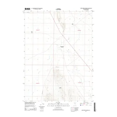
2015 Map of Quinn River Crossing
USGS Topo · Published 2015About this map
Quinn River Crossing stands as a focal point in this high-desert landscape, where the primary waterway carves a path between distinct geographical features. The northern reaches of the Jackson Mountains dominate the southern half of the quadrangle, giving way to the open expanses of Lovely Valley and the edges of the Black Rock Desert to the west. This territory is defined by the intermittent flow of the Quinn River and its tributary, Bilk Cr, which dictate the placement of local thoroughfares. Sparse but essential infrastructure, including Dufurrena Rd and Leonard Creek Rd, traces the contours of the basin, reflecting the remote ranching and transit history of northwestern Nevada. The map details the Township and Range system across these basins, providing a clear view of the land partitions used in this arid region of Humboldt County.
Find a feature on this map
13 named features on this map. Tap any name to fly to it.
Don’t see what you’re looking for? This feature index may not catch every label — zoom into the map to look around manually.
Map Details
Editions of this 2015 Quinn River Crossing Map
This is the sole edition of this map. No revisions or reprints were ever made.
Other maps of this area

1886 · Disaster
USGS Topo · 1:250,000

1893 · Disaster
USGS Topo · 1:250,000

1954 · Vya
USGS Topo · 1:250,000

1958 · Vya
USGS Topo · 1:250,000

1961 · Quinn River Crossing
USGS Topo · 1:62,500

1961 · Bottle Creek
USGS Topo · 1:62,500

1962 · Vya
USGS Topo · 1:250,000

1965 · Duffer Peak
USGS Topo · 1:62,500

1972 · Deer Creek Slough
USGS Topo · 1:24,000

1979 · Denio
USGS Topo · 1:100,000