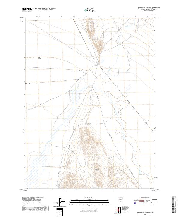
2021 Map of Quinn River Crossing
USGS Topo · Published 2021About this map
The Jackson Mountains dominate the southern landscape of this Nevada interior, providing a stark topographical contrast to the neighboring reaches of the Black Rock Desert. In this high-desert environment, the Quinn River defines the valley floor, weaving through a terrain marked by scattered seasonal drainage and alluvial fans. The network of isolated tracks, including Leonard Creek Rd and Happy Creek Ranch Rd, illustrates the vast distances between remote ranching outposts and grazing lands.
Find a feature on this map
14 named features on this map. Tap any name to fly to it.
Don’t see what you’re looking for? This feature index may not catch every label — zoom into the map to look around manually.
Map Details
Editions of this 2021 Quinn River Crossing Map
This is the sole edition of this map. No revisions or reprints were ever made.
Other maps of this area

1886 · Disaster
USGS Topo · 1:250,000

1893 · Disaster
USGS Topo · 1:250,000

1954 · Vya
USGS Topo · 1:250,000

1958 · Vya
USGS Topo · 1:250,000

1961 · Quinn River Crossing
USGS Topo · 1:62,500

1961 · Bottle Creek
USGS Topo · 1:62,500

1962 · Vya
USGS Topo · 1:250,000

1965 · Duffer Peak
USGS Topo · 1:62,500

1972 · Deer Creek Slough
USGS Topo · 1:24,000

1979 · Denio
USGS Topo · 1:100,000