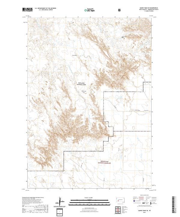
2021 Map of Quinn Table SE
USGS Topo · Published 2021About this map
Badlands National Park dominates the northern half of this landscape, where the high prairie of the Quinn Table breaks into the intricate erosional features of the White River Badlands. The drainage network is defined by Middle Fork Sage Cr and Sage Cr, which carve through the distinct topographic depressions of Sage Creek Basin and Tyree Basin. Crossing the center of the sheet, Sage Creek Pass serves as a natural transition point through the broken terrain. To the south, the protected prairies of the Buffalo Gap National Grassland extend toward the Conata Basin, showing the remote character of Pennington County. The presence of Huether Rd provides the primary corridor through this sparsely populated ranching and conservation area, illustrating the intersection of federal land management and local transit in western South Dakota.
Find a feature on this map
13 named features on this map. Tap any name to fly to it.
Don’t see what you’re looking for? This feature index may not catch every label — zoom into the map to look around manually.
Map Details
Editions of this 2021 Quinn Table SE Map
This is the sole edition of this map. No revisions or reprints were ever made.
Other maps of this area

1950 · Conata
USGS Topo · 1:24,000

1950 · Imlay
USGS Topo · 1:24,000

1950 · Bouquet Table
USGS Topo · 1:24,000

1952 · Bouquet Table
USGS Topo · 1:24,000

1952 · Conata
USGS Topo · 1:24,000

1954 · Quinn Table
USGS Topo · 1:24,000

1955 · Hot Springs
USGS Topo · 1:250,000

1960 · Quinn Table NE
USGS Topo · 1:24,000

1960 · Wall
USGS Topo · 1:24,000

1960 · Quinn Table SE
USGS Topo · 1:24,000