
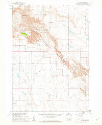
1960 Map of Quinn Table SE
USGS Topo · Published 1962About this map
Badlands National Monument defines the rugged topography of this landscape, where deep erosional basins are separated by high, narrow divides. The drainage patterns of Sage Creek have carved out the Sage Creek Basin, while the Tyree Basin and Conata Basin show the dramatic transition between high plateau tables and lower prairie flats. A single Grave is marked north of Sage Creek Pass, a quiet reminder of early life in this demanding environment before it was formally protected. These natural features, along with the location of Imlay, provide a look at the Pennington County terrain as it was recorded during the 1956 aerial surveys and subsequent 1960 field checks. The map also traces intricate fence and field lines, documenting the boundaries of land use at the edge of the national monument.
Find a feature on this map
9 named features on this map. Tap any name to fly to it.
Don’t see what you’re looking for? This feature index may not catch every label — zoom into the map to look around manually.
Map Details
Editions of this 1960 Quinn Table SE Map
This is the sole edition of this map. No revisions or reprints were ever made.
Other maps of this area

1950 · Conata
USGS Topo · 1:24,000

1950 · Imlay
USGS Topo · 1:24,000

1950 · Bouquet Table
USGS Topo · 1:24,000

1952 · Bouquet Table
USGS Topo · 1:24,000

1952 · Conata
USGS Topo · 1:24,000

1954 · Quinn Table
USGS Topo · 1:24,000

1955 · Hot Springs
USGS Topo · 1:250,000

1960 · Quinn Table NE
USGS Topo · 1:24,000

1960 · Wall
USGS Topo · 1:24,000
1960 · Wall SW
USGS Topo · 1:24,000