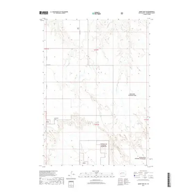
2017 Map of Quinn Table SW
USGS Topo · Published 2017About this map
Badlands National Park and the Buffalo Gap National Grassland dominate this section of Pennington County, showcasing a landscape of high plateaus and carved drainage basins. The flat-topped summits of Quinn Table and Seventyone Table rise above the surrounding terrain, providing clear visual evidence of the region's geological stratification. This high-plains environment is defined by its intermittent water systems, where the S Fork Sage Creek and Beaver Creek wind through the breaks and gullies. Movement through the area follows the historical alignment of Sage Creek Rd and Bear Creek Rd, which provide access to the remote tracts of public land. The map illustrates the sparse, ranching-oriented infrastructure typical of western South Dakota, where the vastness of the federal grasslands and protected parklands preserves the open character of the prairie.
Find a feature on this map
15 named features on this map. Tap any name to fly to it.
Don’t see what you’re looking for? This feature index may not catch every label — zoom into the map to look around manually.
Map Details
Editions of this 2017 Quinn Table SW Map
This is the sole edition of this map. No revisions or reprints were ever made.
Other maps of this area

1950 · Sheep Mountain Table
USGS Topo · 1:24,000

1950 · Imlay
USGS Topo · 1:24,000

1950 · Bouquet Table
USGS Topo · 1:24,000

1952 · Bouquet Table
USGS Topo · 1:24,000

1954 · Scenic
USGS Topo · 1:24,000

1954 · Brennan Flat
USGS Topo · 1:24,000

1954 · Quinn Table
USGS Topo · 1:24,000

1955 · Hot Springs
USGS Topo · 1:250,000

1960 · Quinn Table NE
USGS Topo · 1:24,000

1960 · Quinn Table SE
USGS Topo · 1:24,000