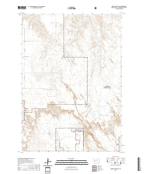
2021 Map of Quinn Table SW
USGS Topo · Published 2021About this map
Quinn Table and Seventyone Table define the high, flat topography of this Pennington County landscape, where the plateau surfaces drop sharply into the intricate drainage networks of the Badlands. This modern survey illustrates the conservation and public land management structure of western South Dakota, showing the meeting point of Badlands National Park and the Buffalo Gap National Grassland. The transition from the tablelands to the valley floors is marked by intermittent waterways including S Fork Sage Cr and Beaver Cr, which have carved deep contours into the soft earth over millennia. Local travel is facilitated by the primary north-south artery of Sage Creek Rd, while the township and range lines of the Public Land Survey System provide the grid for these expansive ranching and protected lands. The map serves as a contemporary record of how human infrastructure like Bear Creek Rd navigates the challenging physical geography of the basin.
Find a feature on this map
15 named features on this map. Tap any name to fly to it.
Don’t see what you’re looking for? This feature index may not catch every label — zoom into the map to look around manually.
Map Details
Editions of this 2021 Quinn Table SW Map
This is the sole edition of this map. No revisions or reprints were ever made.
Other maps of this area

1950 · Sheep Mountain Table
USGS Topo · 1:24,000

1950 · Imlay
USGS Topo · 1:24,000

1950 · Bouquet Table
USGS Topo · 1:24,000

1952 · Bouquet Table
USGS Topo · 1:24,000

1954 · Scenic
USGS Topo · 1:24,000

1954 · Brennan Flat
USGS Topo · 1:24,000

1954 · Quinn Table
USGS Topo · 1:24,000

1955 · Hot Springs
USGS Topo · 1:250,000

1960 · Quinn Table NE
USGS Topo · 1:24,000

1960 · Quinn Table SE
USGS Topo · 1:24,000