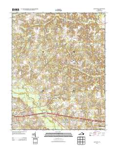
2013 Map of Quinton
USGS Topo · Published 2013About this map
Chickahominy River drainage and the sprawling wetlands of Higgins Swamp define the southern landscape of this New Kent County region. In the early 21st century, the area shows a distinct pattern of residential growth interspersed with larger agricultural tracts like Orapax Farms and Currituck Farms. The map centers on the transition from traditional crossroads and estates like Hampstead and Westwood to modern subdivisions such as Woodview Hills and Bradley Acres.
Find a feature on this map
128 named features on this map. Tap any name to fly to it.
Don’t see what you’re looking for? This feature index may not catch every label — zoom into the map to look around manually.
Map Details
Editions of this 2013 Quinton Map
This is the sole edition of this map. No revisions or reprints were ever made.
Other maps of this area

1894 · Bermuda Hundred
USGS Topo · 1:62,500

1894 · Richmond
USGS Topo · 1:62,500

1895 · Richmond
USGS Topo · 1:62,500

1918 · Charles City
USGS Topo · 1:62,500

1920 · King William
USGS Topo · 1:62,500

1934 · Seven Pines
USGS Topo · 1:24,000

1938 · Dutch Gap
USGS Topo · 1:24,000

1938 · Seven Pines
USGS Topo · 1:31,680

1938 · Studley
USGS Topo · 1:31,680

1943 · Dutch Gap
USGS Topo · 1:31,680