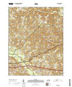
2019 Map of Quinton
USGS Topo · Published 2019About this map
The Chickahominy River defines the southern portion of this landscape, winding through a complex network of wetlands including Chumps Swamp and Boar Swamp. The terrain is characterized by a high density of small water bodies and historical waterworks, such as Beatties Millpond and Parsleys Millpond, which reflect the region's agricultural and industrial history. Settlements like Quinton, Westwood, and Hampstead are connected by a web of local roads, while the presence of Bottoms Bridge indicates a critical crossing point over the river at the intersection of Henrico and New Kent counties.
Find a feature on this map
169 named features on this map. Tap any name to fly to it.
Don’t see what you’re looking for? This feature index may not catch every label — zoom into the map to look around manually.
Map Details
Editions of this 2019 Quinton Map
This is the sole edition of this map. No revisions or reprints were ever made.
Other maps of this area

1894 · Bermuda Hundred
USGS Topo · 1:62,500

1894 · Richmond
USGS Topo · 1:62,500

1895 · Richmond
USGS Topo · 1:62,500

1918 · Charles City
USGS Topo · 1:62,500

1920 · King William
USGS Topo · 1:62,500

1934 · Seven Pines
USGS Topo · 1:24,000

1938 · Dutch Gap
USGS Topo · 1:24,000

1938 · Seven Pines
USGS Topo · 1:31,680

1938 · Studley
USGS Topo · 1:31,680

1943 · Dutch Gap
USGS Topo · 1:31,680