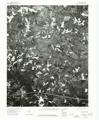
1974 Map of Quinton
USGS Topo · Published 1977About this map
Quinton, Virginia, is captured in this mid-1970s orthophotoquad, which reveals the interplay between agricultural clearing and dense woodland in New Kent County. The map provides a unique aerial perspective of the rural landscape, showing the distinct patterns of property lines and timber tracts that defined the region during this period. The settlement of Quinton serves as a central point of reference, surrounded by an intricate network of secondary roads and farm lanes. This photographic record is particularly useful for observing land-use changes and the specific layout of forest cover before later residential development altered the traditional rural character of the area.
Find a feature on this map
1 named feature on this map. Tap any name to fly to it.
Don’t see what you’re looking for? This feature index may not catch every label — zoom into the map to look around manually.
Map Details
Editions of this 1974 Quinton Map
This is the sole edition of this map. No revisions or reprints were ever made.
Other maps of this area

1894 · Bermuda Hundred
USGS Topo · 1:62,500

1894 · Richmond
USGS Topo · 1:62,500

1895 · Richmond
USGS Topo · 1:62,500

1918 · Charles City
USGS Topo · 1:62,500

1920 · King William
USGS Topo · 1:62,500

1934 · Seven Pines
USGS Topo · 1:24,000

1938 · Dutch Gap
USGS Topo · 1:24,000

1938 · Seven Pines
USGS Topo · 1:31,680

1938 · Studley
USGS Topo · 1:31,680

1943 · Dutch Gap
USGS Topo · 1:31,680