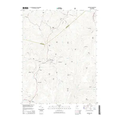
2014 Map of Quinwood
USGS Topo · Published 2014About this map
Quinwood and the surrounding coal-country settlements of Crichton, Marfrance, and Leslie occupy the rugged terrain where the Nicholas and Greenbrier County line bisects the landscape. The region's industrial and social infrastructure is evident along the Coalfield Trail and the banks of Meadow Creek, connecting smaller hamlets like Bellburn and Orient Hill. To the south, the village of Charmco sits near the confluence of Laurel Creek and the Meadow River.
Find a feature on this map
90 named features on this map. Tap any name to fly to it.
Don’t see what you’re looking for? This feature index may not catch every label — zoom into the map to look around manually.
Map Details
Editions of this 2014 Quinwood Map
This is the sole edition of this map. No revisions or reprints were ever made.
Other maps of this area

1887 · Hinton
USGS Topo · 1:125,000

1889 · Nicholas
USGS Topo · 1:125,000

1891 · Nicholas
USGS Topo · 1:125,000

1892 · Hinton
USGS Topo · 1:125,000

1901 · Nicholas
USGS Topo · 1:125,000

1912 · Meadow Creek
USGS Topo · 1:48,000

1914 · Winona
USGS Topo · 1:48,000

1915 · Meadow Creek
USGS Topo · 1:62,500

1916 · Winona
USGS Topo · 1:62,500

1918 · Richwood
USGS Topo · 1:62,500