2019 Map of Quinwood
USGS Topo · Published 2019About this map
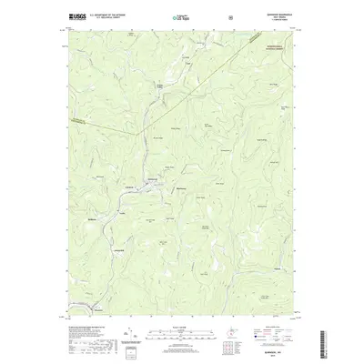
The town of Quinwood and its neighboring coal-country settlements define this portion of the Nicholas and Greenbrier county line. The map illustrates a densely settled corridor along the Meadow River, where communities like Crichton, Marfrance, Leslie, and Bellburn are closely spaced, reflecting the region's industrial residential patterns. To the north and east, the terrain rises into the Monongahela National Forest, dominated by prominent ridges such as Peaser Ridge and Huggins Ridge. This juxtaposition of concentrated valley settlements and expansive forest highlands highlights the geographical constraints on development in the West Virginia mountains. Local heritage is marked by sites like the Mountain Cem near Carl and a network of named heights including Pollock Mtn and Big Clear Creek Mtn. The detailed road network, from Main St in Crichton to the Coalfield Trl, provides a clear view of the transportation links between these upland towns.
Find a feature on this map
88 named features on this map. Tap any name to fly to it.
Don’t see what you’re looking for? This feature index may not catch every label — zoom into the map to look around manually.
Map Details
Editions of this 2019 Quinwood Map
This is the sole edition of this map. No revisions or reprints were ever made.
Other maps of this area

1887 · Hinton
USGS Topo · 1:125,000

1889 · Nicholas
USGS Topo · 1:125,000

1891 · Nicholas
USGS Topo · 1:125,000

1892 · Hinton
USGS Topo · 1:125,000

1901 · Nicholas
USGS Topo · 1:125,000

1912 · Meadow Creek
USGS Topo · 1:48,000

1914 · Winona
USGS Topo · 1:48,000

1915 · Meadow Creek
USGS Topo · 1:62,500

1916 · Winona
USGS Topo · 1:62,500

1918 · Richwood
USGS Topo · 1:62,500