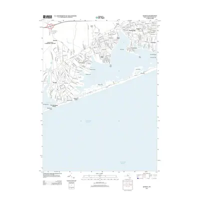
2013 Map of Quogue
USGS Topo · Published 2013About this map
Quogue and its surrounding coastal hamlets occupy a landscape defined by the intricate waterways of the South Shore. The Long Island RR runs parallel to the Montauk Hwy, connecting established settlements like East Quogue and Hampton Bays. This modern survey illustrates the proximity of residential development to the expansive Atlantic Ocean, separated only by the narrow barrier of Westhampton Island and its sandy reaches at Tiana Beach.
Find a feature on this map
208 named features on this map. Tap any name to fly to it.
Don’t see what you’re looking for? This feature index may not catch every label — zoom into the map to look around manually.
Map Details
Editions of this 2013 Quogue Map
This is the sole edition of this map. No revisions or reprints were ever made.
Other maps of this area

1903 · Sag Harbor
USGS Topo · 1:62,500

1903 · Riverhead
USGS Topo · 1:62,500

1904 · Sag Harbor
USGS Topo · 1:62,500

1904 · Riverhead
USGS Topo · 1:62,500

1943 · Riverhead
USGS Topo · 1:62,500

1947 · Mattituck
USGS Topo · 1:24,000

1947 · Southampton
USGS Topo · 1:24,000

1947 · Riverhead
USGS Topo · 1:24,000

1947 · Quogue
USGS Topo · 1:24,000

1947 · Eastport
USGS Topo · 1:24,000
Featured Places
- Southampton, NY
- Hampton Bays, Southampton
- East Quogue, Southampton
- Flanders, Southampton
- Westhampton, Southampton