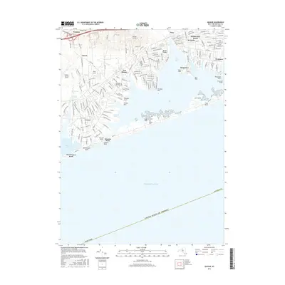
2016 Map of Quogue
USGS Topo · Published 2016About this map
Hampton Bays and the surrounding South Shore communities are detailed in this 2016 survey, showcasing the complex interface of Long Island's maritime and residential geography. The map traces the winding shoreline from Quantuck Bay to Tiana Bay, highlighting the barrier beach formations of Westhampton Island and Hampton Beach. Infrastructure is central to the area's layout, including the Post Lane Bridge and Ponquogue Bridge which connect the mainland to the outer banks, alongside the significant footprint of the Francis S Gabreski Airport in the northwest.
Find a feature on this map
174 named features on this map. Tap any name to fly to it.
Don’t see what you’re looking for? This feature index may not catch every label — zoom into the map to look around manually.
Map Details
Editions of this 2016 Quogue Map
This is the sole edition of this map. No revisions or reprints were ever made.
Other maps of this area

1903 · Sag Harbor
USGS Topo · 1:62,500

1903 · Riverhead
USGS Topo · 1:62,500

1904 · Sag Harbor
USGS Topo · 1:62,500

1904 · Riverhead
USGS Topo · 1:62,500

1943 · Riverhead
USGS Topo · 1:62,500

1947 · Mattituck
USGS Topo · 1:24,000

1947 · Southampton
USGS Topo · 1:24,000

1947 · Riverhead
USGS Topo · 1:24,000

1947 · Quogue
USGS Topo · 1:24,000

1947 · Eastport
USGS Topo · 1:24,000
Featured Places
- Southampton, NY
- Hampton Bays, Southampton
- East Quogue, Southampton
- Flanders, Southampton
- Westhampton, Southampton