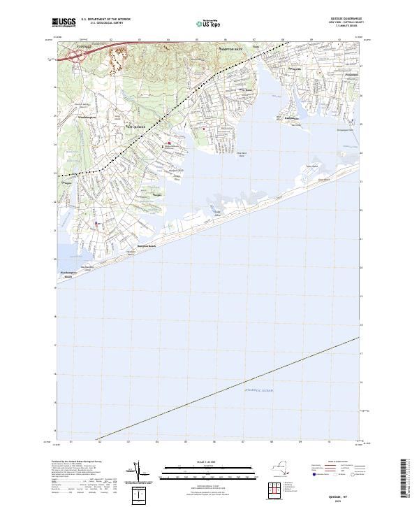
2023 Map of Quogue
USGS Topo · Published 2023About this map
Francis S. Gabreski Airport and the surrounding residential corridors of Westhampton define the western portion of this Suffolk County coastal study. The landscape is characterized by a complex network of glacial kettle ponds and tidal inlets, where the Long Island railroad line segments the interior woodland from the dense shorefront settlements of East Quogue and Hampton Bays.
Find a feature on this map
182 named features on this map. Tap any name to fly to it.
Don’t see what you’re looking for? This feature index may not catch every label — zoom into the map to look around manually.
Map Details
Editions of this 2023 Quogue Map
This is the sole edition of this map. No revisions or reprints were ever made.
Other maps of this area

1903 · Sag Harbor
USGS Topo · 1:62,500

1903 · Riverhead
USGS Topo · 1:62,500

1904 · Sag Harbor
USGS Topo · 1:62,500

1904 · Riverhead
USGS Topo · 1:62,500

1943 · Riverhead
USGS Topo · 1:62,500

1947 · Mattituck
USGS Topo · 1:24,000

1947 · Southampton
USGS Topo · 1:24,000

1947 · Riverhead
USGS Topo · 1:24,000

1947 · Quogue
USGS Topo · 1:24,000

1947 · Eastport
USGS Topo · 1:24,000
Featured Places
- Southampton, NY
- Hampton Bays, Southampton
- East Quogue, Southampton
- Flanders, Southampton
- Westhampton, Southampton