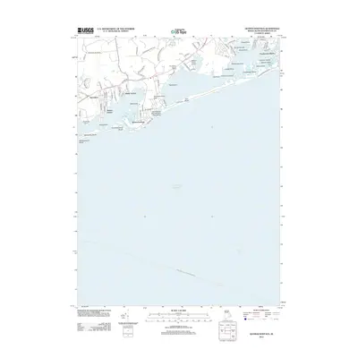
2012 Map of Quonochontaug
USGS Topo · Published 2012About this map
Quonochontaug Neck and the barrier beaches of Washington County define this coastal landscape, where the Atlantic Ocean meets a series of complex salt ponds and breachways. The residential patterns of Haversham, Shelter Harbor, and Shady Harbor reflect a post-war era of coastal development, punctuated by seasonal landmarks like the Weekapaug Inn Beach and the Sam Ferretti Blue Shutters Town Beach. Further inland, the Woody Hill Man Area provides a contrast of managed woodland against the densely platted streets of Charlestown Beach. Transportation and recreation are centered around the water, with the Willows Resort Airport situated near Foster Cove. The map also traces the New London - Block Island Ferry Crossing as it transits through Block Island Sound, illustrating the region's enduring role as a maritime corridor.
Find a feature on this map
85 named features on this map. Tap any name to fly to it.
Don’t see what you’re looking for? This feature index may not catch every label — zoom into the map to look around manually.
Map Details
Editions of this 2012 Quonochontaug Map
This is the sole edition of this map. No revisions or reprints were ever made.
Other maps of this area

1889 · Stonington
USGS Topo · 1:62,500

1889 · Charlestown
USGS Topo · 1:62,500

1889 · Block Island
USGS Topo · 1:62,500

1893 · Stonington
USGS Topo · 1:62,500

1894 · Block Island
USGS Topo · 1:62,500

1899 · Block Island
USGS Topo · 1:62,500

1904 · Montauk
USGS Topo · 1:62,500

1919 · Charlestown
USGS Topo · 1:62,500

1921 · Charlestown
USGS Topo · 1:62,500

1921 · Stonington
USGS Topo · 1:62,500