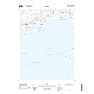
2018 Map of Quonochontaug
USGS Topo · Published 2018About this map
The coastal village of Quonochontaug sits at the heart of this Rhode Island shoreline, where the land is defined by a series of salt ponds and breachways connecting to Block Island Sound. The map reveals a dense network of seasonal and year-round residential developments including Shelter Harbor, Shady Harbor, and Haversham, situated along the northern shores of the ponds. The landscape is a complex of points and islands, such as Quonochontaug Neck, Bills Island, and The Hummocks, that have long shaped the maritime character of Washington County.
Find a feature on this map
80 named features on this map. Tap any name to fly to it.
Don’t see what you’re looking for? This feature index may not catch every label — zoom into the map to look around manually.
Map Details
Editions of this 2018 Quonochontaug Map
This is the sole edition of this map. No revisions or reprints were ever made.
Other maps of this area

1889 · Stonington
USGS Topo · 1:62,500

1889 · Charlestown
USGS Topo · 1:62,500

1889 · Block Island
USGS Topo · 1:62,500

1893 · Stonington
USGS Topo · 1:62,500

1894 · Block Island
USGS Topo · 1:62,500

1899 · Block Island
USGS Topo · 1:62,500

1904 · Montauk
USGS Topo · 1:62,500

1919 · Charlestown
USGS Topo · 1:62,500

1921 · Charlestown
USGS Topo · 1:62,500

1921 · Stonington
USGS Topo · 1:62,500